


Location of the City
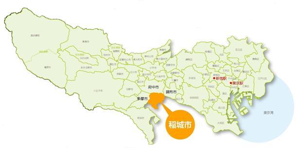
Our city is located at the eastern edge of the Minami-Tama area, bordering Kawasaki City in Kanagawa Prefecture from the southeast to the west, and to the north, it is adjacent to Fuchu City and Chofu City across the Tama River, while to the west, it borders Tama City.
Located approximately 25 kilometers southwest of Shinjuku in central Tokyo (longitude 139 degrees 30 minutes 16 seconds, latitude 35 degrees 38 minutes 17 seconds), it forms a nearly triangular shape with a length of about 5.3 kilometers in both east-west and north-south directions, with the Tama River marking its northern boundary, covering an area of 17.97 square kilometers.
To the south, there is the gentle Tama Hills, with an elevation of about 45 to 80 meters (highest elevation 162 meters), running parallel to the Tama River. Additionally, the Misawa River flows through the central part of the city, dividing it into the northwest and southeast sections, while the Yato River flows from the southwest to the northeast in the Omaru area.
Please let us know your feedback on how to make our website better.
Inquiries about this page
Inagi City Planning Department Secretarial and Public Relations Division
2111 Higashi-Naganuma, Inagi City, Tokyo 206-8601
Phone number: 042-378-2111 Fax number: 042-377-4781
Contact the Inagi City Planning Department Secretarial and Public Relations Division