Daimaru Canal - Focusing on the history of the Edo period -

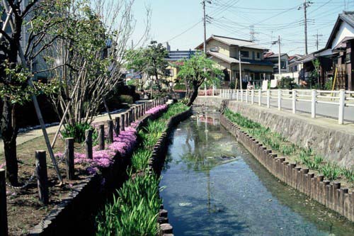
Sugebori of Daimaru canal (near Higashi Naganuma)
History of Daimaru Canal
Daimaru Waterway It is an irrigation canal that takes water from the Tama River in Omaru, Inagi City and flows to Noborito, Kawasaki City. Since the Edo period, it has been maintained and managed as a very important agricultural water source that irrigates the villages in Inagi City and downstream villages. excavation There are no clear historical documents regarding the time period, but it is believed to have been during the Edo Shogunate. Tax A large-scale project aimed at increasing revenues flood control・Water Use It is believed to have been built around the 17th century as part of a government policy. Nigaryo Irrigation Canal This shows that excavation work for large-scale irrigation canals was carried out in various parts of the Tama River basin during this period. Nobuyuki 3rd year (1746) Ancient documents According to the Sahota family documents (Kawasaki City), Genroku It is recorded that the Daimaru Waterworks Association had been paying for repair materials since 1699, so it is believed that the association was established at least until the 17th century. frenzy There is no doubt that this will be the case.
Flow path of Daimaru water
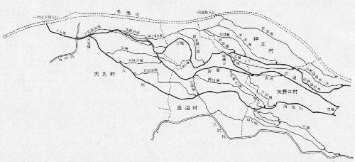
The outline of the canal route is as follows. The intake was at "Ichinoyamashita" in Daimaru (slightly upstream of the current Tamagawa railway bridge on the Nambu Line). It was about 100 meters long on the Tamagawa River. while (about 182 meters) Water Intake Weir The Tama River was dammed up here, and the water was cut off twice as wide. while (About 3.6 meters) of water Irihi The water was taken from the sluice gate (a drain for drawing in irrigation water). The water first passed through the inner moat Volumetric gutter The water supply for Omaru Village is separated from that for other villages. Attached In the drained gutter, Moat width The ratio of the land was 1 for Daimaru Village and 2 for other villages. Water Diversion The water supply for Daimaru Village was Ohori It is called the "Omaru River", and it irrigates the southern part of Omaru Village, then flows through Naganuma Village and Yanokuchi Village, and then heads towards Kawasaki. On the other hand, the irrigation water for other villages is in the eastern part of Omaru Village. Sugahori and New moat The Shinbori moat flows through the center of Naganuma village, while the Sugawara moat flows around the northern part of the village and then heads towards Osatate village. Fighting The water was then divided into three streams at a water diversion point called the Yanoguchi. The water was then divided into several streams, and was then further divided into a network to irrigate the rice fields of the villages downstream in the Kawasaki region.
Villages using irrigation water
During the Edo period, the areas that used the Daimaru Irrigation Canal included four villages in the Inagi area (Daimaru Village, Naganuma Village, Oshidate Village, and Yanokuchi Village) and five villages in the Kawasaki area ( Suga village· Nakano Island village· Sugo village· Gotanda village· Noborito These villages were Tachibana tree The area spanned two districts, Omarugun and Tamagun, and was ruled by different feudal lords, but they all agreed on using the Omaru Canal, and organized the "Omaru Canal Nine Villages Association." The most important task of this association was to maintain and manage the canal, including repairing the canal itself, Water Weir・Irihi The facilities were repaired, and these Construction The materials used for this were paid for by each village. Water dispute Iga Frequent The water dispute took place during the summer. During drought There were various disputes, such as those over the distribution of water in the area and the construction of irrigation dams on the Tama River, and villages submitted petitions to the shogunate on each occasion. Sue and sought a ruling.

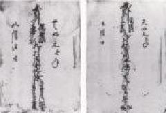
Old document on water repair (Ashikawa family document)

Old documents about water disputes (Saboda family documents)
Current Daimaru Canal
The Daimaru Waterway, which has been maintained and managed since the Edo period, is gradually losing its function as an agricultural water source in modern times. The current management is carried out by the " Daimaru Waterworks Land Improvement District The " Waterside Park" is a public park that protects the area of irrigation waterways from the elements, but the area of cultivated land that uses the waterways is decreasing year by year. The waterways are no longer needed due to the decline in rice paddies, and are being filled in, causing changes to the area's appearance, but in recent years they have been developed into new waterside parks, and the area continues to live on as a valuable waterfront.
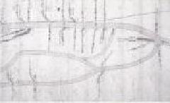
Waterway map of the Daimaru Waterway (based on the Inagi City History Scroll)
Water dispute Ino ancient documents (Sahota family documents)
Old documents on waterway repairs (Ashigawa family documents)

Daimaru irrigation waterway map (created from Inagi city historical volume)


