


Eel disaster prevention map
Update date: April 21, 2023
Eel disaster prevention map (published in September 2021)
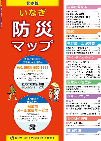
The Inagi Disaster Prevention Map is prepared in the form of a booklet so that everyone can easily understand it in preparation for earthquake disasters, heavy rain disasters, and landslides, and provides information on evacuation centers for each type of disaster, how to obtain information issued by the city in the event of a disaster, By providing everyone with accurate knowledge and information about disaster prevention, such as how to prepare for earthquakes, wind and flood damage, and how to create your own timeline, we aim to improve disaster prevention awareness, and we have created this guide so that you can take self-help and mutual aid actions in the event of a disaster. did.
Please use this as a resource to learn about disaster prevention in Inagi City, such as initiatives at home and in the community.
A PR video of the Inagi disaster prevention map is posted on the Inagi City official YouTube video channel.
Please check it out and think about disaster prevention!
Video provided by: Tama TV Music provided by: FREE BGM DOVA SYNDROME
Inagi disaster prevention map download
![]() Prepare for disasters (PDF: 3,325KB)
Prepare for disasters (PDF: 3,325KB)
![]() Wind, flood, and landslide disasters (PDF: 2,984KB)
Wind, flood, and landslide disasters (PDF: 2,984KB)
![]() Points to note during evacuation (PDF: 1,793KB)
Points to note during evacuation (PDF: 1,793KB)
![]() Hazard map index diagram (PDF: 403KB)
Hazard map index diagram (PDF: 403KB)
![]() Hazard map [for earthquake disaster] (PDF: 1,839KB)
Hazard map [for earthquake disaster] (PDF: 1,839KB)
![]() Tama River flood expected area map (PDF: 850KB)
Tama River flood expected area map (PDF: 850KB)
![]() Misawa River Basin and Tsurumi River Basin Inundation Expected Area Map (PDF: 818KB)
Misawa River Basin and Tsurumi River Basin Inundation Expected Area Map (PDF: 818KB)
![]() Hazard map [for wind, flood, and landslide disasters] (PDF: 3,773KB)
Hazard map [for wind, flood, and landslide disasters] (PDF: 3,773KB)
![]() Other disasters/life reconstruction (PDF: 1,818KB)
Other disasters/life reconstruction (PDF: 1,818KB)
Regarding revision of guidelines regarding evacuation information (enforced on May 20, 2021)
In response to the revision of the Disaster Countermeasures Basic Act (promulgated on May 10, 2021 and enforced on May 20, 2021), the Cabinet Office's "Guidelines for Evacuation Information" have been revised. The city also reviewed evacuation information based on alert levels and revised some of the eel disaster prevention maps. For details, please refer to the page below.
Regarding revision of guidelines regarding evacuation information (enforced on May 20, 2021)
Web version of eel hazard map
We operate a web version of the Inagi Hazard Map, which allows you to view information necessary for disaster prevention overlaid on a map.
With the web version of Inagi Hazard Map, you can check landslide hazard areas, river flooding areas, designated evacuation shelters, etc. from your computer or smartphone.
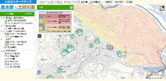
Click here for the web version of the Inagi Hazard Map
Tokyo disaster prevention map
You can search for evacuation shelters and evacuation sites in Tokyo on the Tokyo Disaster Prevention Map (Tokyo Disaster Prevention Homepage).
![]() Tokyo disaster prevention map (external link)
Tokyo disaster prevention map (external link)
Adobe Acrobat Reader DC (formerly Adobe Reader) is required to open PDF files.
If you don't have it, you can download it for free from Adobe.
![]() Download Adobe Acrobat Reader DC
Download Adobe Acrobat Reader DC
Inquiries regarding this page
Inagi City Fire Department Headquarters Disaster Prevention Division
2111 Higashi-Naganuma, Inagi-shi, Tokyo (Inagi Fire Department)
Phone: 042-377-7119 Fax: 042-377-0119