Last updated: March 27, 2024
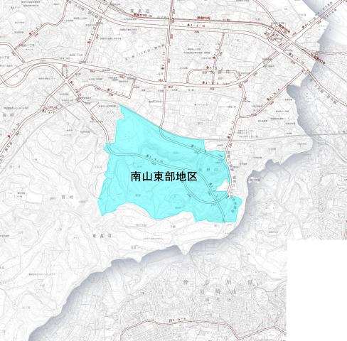
This project area is located approximately halfway between Inagi Station and Keio Yomiuriland Station on the Keio Sagamihara Line, and is located in the southeastern part of Inagi City. The area is bordered by the Keio Sagamihara Line to the north, Metropolitan Route 124 to the east, a golf course to the south, and City Route 1494 to the west, as well as residential land.
Name Nanzan Eastern Land Readjustment Association Address 1462-1 Hyakumura, Inagi City
Phone 042-378-5773
| Business name | Inagi Minamiyama eastern land readjustment project |
|---|---|
| enforcer | Nanzan Eastern Land Readjustment Association |
| Date of establishment approval | April 12, 2006 |
| First business plan change approval date | September 29, 2008 |
| 2nd business plan change approval date | February 24, 2012 |
| 3rd business plan change approval date | September 2, 2013 |
4th business plan change approval date |
June 14, 2016 |
5th business plan change approval date |
June 2, 2017 |
| 6th Business Plan Change Approval Date | December 21, 2018 |
7th business plan change approval date |
March 10, 2020 |
8th Business Plan Change Approval Date |
April 11, 2020 |
| 9th Business Plan Change Approval Date | March 21, 2020 |
| Enforcement period | From 2006 to 2020 |
| Implementation area | Approximately 87.46 hectares |
| expense | Approximately 64 billion yen |
| Number of union members | 351 people |
| Step loss rate | Total step loss rate 68.62% |
Tama City Planning Road No. 3, 4, 12 Yomiuri Land Line (changed on June 23, 2006)
Tama City Planning Road No. 3, 4, 16 Inagi Minami Tama Line (changed on June 23, 2006)
Tama City Planning Road No. 7, 4, 5 Higashi Naganuma Yanoguchi Line (determined on June 23, 2006)
Tama City Planning Roads 7, 5, and 6 Nanzan Street Route 1 (determined on March 9, 2018)
Tama City Planning Road No. 7, 5, 7 Nanzan Street No. 2 (determined on March 9, 2018)
Tama City Planning Park No. 4, 4, 3 Okuhata Yato Park (changed on March 9, 2018)
Tama City Planning Park No. 3, 3, 23 Negata Yato Park (determined on March 9, 2018)
Tama City Planning Park No. 2, 2, 32 Nanzan 1st Park (determined on March 9, 2018)
Tama City Planning Park No. 2, 2, 33 Nanzan 2nd Park (determined on March 9, 2018)
Tama City Planning Green Space No. 10 Nanzan No. 1 Green Space (determined on March 9, 2018)
Tama City Planning Green Space No. 11 Nanzan 2nd Green Space (determined on March 9, 2018)
Tama City Planning Green Space No. 12 Nanzan No. 3 Green Space (determined on March 9, 2018)
Tama City Planning Green Space No. 13 Nanzan Green Space 4 (determined on March 9, 2018)
Tama City Planning Green Space No. 14 Nanzan No. 5 Green Space (determined on March 9, 2018)
Tama City Planning Green Space No. 15 Nanzan No. 6 Green Space (determined on March 9, 2018)
Tama City Planning Green Space No. 16 Nanzan No. 7 Green Space (determined on March 9, 2018)
Parts of Oaza Hyakumura, Inagi City, Higashi-Naganuma, and Yanoguchi

Inagi City Urban Environment Development Department Land Readjustment Division Phone: 042-378-2111