Last updated: April 22, 2024
Inagi City
Located in the eastern part of Inagi City, there are four urban planning roads within the area (Ta 3, 1, and 6 Minami-Tama One Main Line, Ta 3, 4, and 12 Yomiuri Land Line, Ta 7, 5, and 2 Park). The area is expected to create a good urban landscape, with the planned layout of Tori-no-Michi Line, Ta-7, No. 5, and No. 3 Shuku Enokido Line, and in conjunction with the environmental bank improvement project that will be implemented adjacent to the Misawa River. is.
November 18, 1988 Tokyo Metropolitan Government Notice No. 1108
December 4, 1989 Inagi City Public Notice No. 19
From 1989 to 2020
25.3 hectares
23.88% (Public walking reduction rate)
2.30% (reservation land reduction rate)
26.18% (total loss rate)
22.9 billion yen
6.9 billion yen Maintenance costs for urban planning roads (Tama-3, 1, 6 Minami-Tama-one trunk line, etc.)
4.8 billion yen Maintenance costs for urban planning roads (Tama 3, 1, and 6 Minami-Tama-one trunk line)
1.1 billion yen
10.1 billion yen
Building relocation began in the southern part of the district in fiscal 1994. Currently, building relocation, block road construction, and land leveling work are being carried out in the northwest part of the district, and the project is progressing smoothly.
| Overall plan | Until the end of 2020 | Progress rate | |
|---|---|---|---|
| urban planning road | 1,766 meters | 1,102 meters | 62.4% |
| section road | 5,494 meters | 5,197 meters | 94.6% |
| Designated area for temporary replacement land | 160,105 square meters | 155,411 square metres | 97.1% |
| Number of buildings relocated | 480 buildings | 469 buildings | 97.7% |

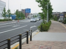
The Minamitama Ridge Main Line was completed in March 2008 with the sidewalk paving completed.
Misawa River environmental protection bank opened in April 2007
Inagi City Urban Environment Development Department Land Readjustment Division Phone: 042-378-2111