Last updated: November 1, 2016
It is located about 25 kilometers southwest of Shinjuku in central Tokyo. The neighboring cities are Fuchu City, Chofu City, Tama City, and Kawasaki City in Kanagawa Prefecture. It is 139 degrees 30 minutes 29 seconds east longitude and 35 degrees 38 minutes 5 seconds north latitude.
It is approximately 5.3 kilometers long from east to west and north to south, and has an area of 17.97 square kilometers.

It was created with the image of the "i" of eel. It shows the spirit of all citizens working together to create a city that is a pleasant place to live.
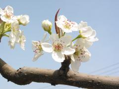
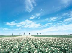
This is a pear flower, which is a special product of Inagi. It began to be created in the Edo period, and even today it is still located in Yanokuchi, Oshidate, and Higashinaganuma. Pear fields (Nashibatake) are spread out around the area.
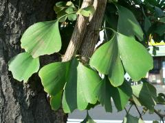
Ginkgo trees were chosen because they are resistant to pollution, suitable as roadside trees, and have a dignified appearance.
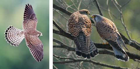
To commemorate the 45th anniversary of the founding of Inagi City, the kestrel was chosen as the city's bird. It is a representative bird that shows the abundance of nature in Inagi City.
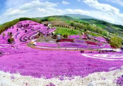
Located in the northeastern part of Hokkaido, Lake Abashiri, Mt. Mokoto, Higashimokoto and Shibasakura are located in the northeastern part of Hokkaido. It is a town that is rich in nature throughout the four seasons, including parks.
The main industry is agriculture, which produces wheat, potatoes, sugar beets (a raw material for granulated sugar), and beans. ) and are cultivated in a wide variety of ways.
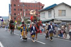
Located in the northern part of Hamadori in Fukushima Prefecture, it is the center of transportation and culture. .
It is famous for the traditional event of Soma Nomaoi.
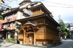
Located in the northern part of Nagano Prefecture, it has flourished as a hot spring resort since ancient times.
It is also famous as the birthplace of Nozawana and as a ski resort.